‘Terrifying’ simulation shows what Hurricane Milton’s potential disastrous surge impact can look like
The Tampa Bay Area is expected to experience ‘a record-setting surge over 9 feet’
A ‘terrifying’ simulation shows the potential disastrous storm surge impact that can arise when Hurricane Milton makes landfall.
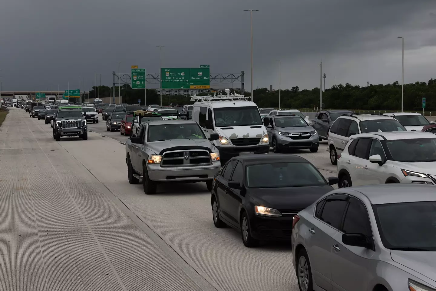
Currently barreling toward the Florida Peninsula, Hurricane Milton recently regained its Category 5 strength earlier this evening as millions evacuate expected vulnerable areas and prepare for the incoming storm.
The National Hurricane Center said Milton presents an ‘extremely life-threatening situation’ for the western coast of Florida, with one of the center’s specialists John Cangialosi warning: “Milton has the potential to be one of the most destructive hurricanes on record for west-central Florida.”
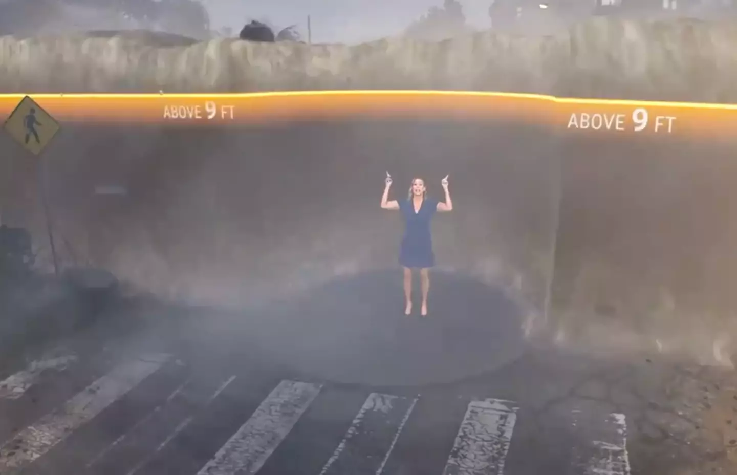
As the National Hurricane Center announced that storm surges are expected to occur along parts of Florida‘s west coast tomorrow, The Weather Channel released a simulation earlier today anticipating what the surge might look like in the Tampa Bay Area where storm surges are expected to hit ‘a record-setting surge over 9 feet’.
Using FloodFX simulation technology, The Weather Channel’s meteorologist Stephanie Abrams demonstrated what a 9 feet surge will look like in the Tampa Bay Area.
As animated water rose behind her, Abrams explained: “At 3 feet above normally dry ground, water is already life-threatening. It’s too late to evacuate.
“Water this high can knock you off your feet, make cars float, and driving impossible. The first floor of homes and businesses are flooded.
“Unfortunately the water is expected to rise even higher at 6 feet, above the height of most people. Vehicles get carried away, structures start to fail,” Abrams continued.
“Anything can be in this water, sharp glass, debris, chemicals as well.”
Hurricane Milton is expected to bring a destructive storm surge to Florida's west coast. @StephanieAbrams uses our FloodFX simulation technology to show you what that could look like ⬇️ pic.twitter.com/rg996zNHy2
— The Weather Channel (@weatherchannel) October 8, 2024
“The scary part is some areas could see surge values at 10 to 15 feet,” Abrams added as the water simulation horrifyingly rose behind her. “At this level, the first floors of structures are completely flooded and there are few places that it is safe when the water rises this high.”
Users on Twitter described the simulation as ‘terrifying,’ with some urging local residents to evacuate if they haven’t already.
“Flood simulation to show how high the storm surge from Hurricane Milton could get. This is a wake up call to leave if you haven’t already,” one user wrote.
“I got claustrophobic just watching it,” another added.
Another noted, “That visualization is showing static water, no movement. The surge will have 9 foot swells and water levels with FORCE.”